Monday, April 30, 2012

BEARPEN/VLY/GRAHAM/BALSAM CATSKILL 35 MTNS (The "Good Fortune" Hike)

I headed to the Western Catskills for the 2nd time in a week to hike the 4 Catskill 35 mountains left in that area. I went to the end of Rt 3 near Halcott and drove my Jeep up to the pass between Bearpen and Vly Mtns in Bearpen State Forest, just outside the Catskill Park. I parked on state land and started up the easy to follow property line herdpath that leads up to Vly Mtn. It was a steep climb in spots but very short, it took less than 30 mins to reach the summit canister, my fastest Catskill High Peak!...
There was a survey marker nearby too...
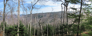
On the way back down there was a view through the trees towards Bearpen Mtn...
I made it back down to the Jeep and got some more water and hiked past the hunters cabin on the snowmobile trail towards Bearpen Mtn...
I enjoyed the spring wildflowers along the way including Trout Lillies...
Eventually I came out to the summit area with the remains of an old ski area and some nice views towards the Schoharie Reservoir...
I wandered around to find the true summit according to my GPS...
I headed back down the snowmobile trails back to the Jeep, stretched and got ready to head to my next hike...


I headed over to the Dry Brook Ridge TH on Millbrook RD to hike Graham Mtn. I headed up the trail, an old Jeep Rd, towards the junction with the Graham herdpath. I came across this interesting rock formation in a boulder along the way....
I found the herdpath (old rd) to Graham and headed east. The path was very easy to follow and I made good time enjoying the spring wildflowers along the trail...
The trail switchbacked up to a small overlook just below the summit with a view of the Dry Brook Valley...
Shortly after was the summit with the remains of an old TV tower. There were pretty extensive views over the small trees near the summit...

I headed back to the Dry Brook Ridge Trail and back to the TH quickly so I would have enough time before dark to climb nearby Balsam Mtn.

I got back to the Jeep and headed over to Rider Hollow for my final climb of the day up Balsam Mtn. This was my 2nd climb up in the last few months as this mountain has to be climbed twice for the Catskill 3500 Club requirements. I arrived and quickly began up the trail. I ran into one hiker and we chatted for a few minutes.
About 2/3 of the way up the mountain I was really struggling from all the hiking I had done already when I looked on the trail and saw, of all things, a fortune from a fortune cookie! It read "Good fortune is always on your side." I thought this was a rather odd thing to find on a hiking trail, but it distracted me from the task at hand for a while.
 The skies started to cloud up a bit on the ascent and right near the summit some hail pellets fell for a few minutes, even with the sun shining!
I headed back down Rider Hollow and enjoyed the late afternoon breezes and sunlight as I followed and crossed the streams.

Nearing the Trailhead I also noticed a "No Camping" Disc on a tree, but because of Hurricane Irene it was now located in the middle of the stream!
I made it back to the trailhead as it was getting dark in the valley. A long tough day out, but a great day to be out in the woods for sure.


Friday, April 27, 2012

BIG INDIAN/FIR/DOUBLETOP CATSKILL 35 BUSHWACKS (The "Boomhower" Hike)

I left the house in the morning headed for the Western Catskills. As I got close to the mountains, some flurries started up and the clouds were thick. I also saw some light snow in the higher elevations. When I arrived at Seager TH, the winds were whipping and it was chilly, quite a difference from my last hike! I geared up and headed up the Seager Trail along Dry Brook. There were a couple crossings but nothing too difficult...

Along the way I saw the Hobblebush was flowering...
After a short while I came to the Shandaken Lean-To...
After the Lean-To the climb up to the ridge started and was pretty steep for a while until I met the Pine Hill-West Branch Trail junction...
There was a dusting of snow as I headed south towards Big Indian Mtn...
I got restless looking for the herdpath to the summit of Big Indian so I just headed up through the woods and found the canister...
I then turned east to bushwack to Fir mountain. It was a fairly difficult 1.5 miles over the Catskill Divide (a narrow ridge that seperates the Hudson/Delaware River watersheds). At the summit I stopped for a break at the canister...
I headed back across the ridge and back up to Big Indian Mtn where I had something to eat and changed into new socks/boots. I decided that since I was up here I might as well bushwack over to Doubletop Mtn as well. I found the property line that runs across the ridge and followed it towards the mountain...
I left the property line and headed up to the col between the summits, It was steep up higher and near the top there was actually some snow left in the pines...

I found a herdpath and followed it a short ways to the summit canister...
It was a chilly and rather gloomy day, so I didn't hang around to find any viewpoints, but I was lucky enough to stumble upon on a boulder on the descent with a nice view of the Dry Brook Valley below...
I descended the ridge back down to the valley below and it seemed to take quite a while before I came out near where Flat Iron Brook meets Dry Brook which was a beautiful area with many cascades...
I met up with the Seager Trail and then it was just a nice walk of about a mile back to the TH along Dry Brook...
It was a tough hike of about 12 miles of which about 1/2 was bushwacking, but I'm glad I spent the day in the woods and challenged myself.
I'm a big fan of the cartoon "King Of The Hill" and was delighted to see this sign on the drive home...

Monday, April 16, 2012

3 CATSKILL 35 HIGH PEAKS! (The "Catskill Marathon 5000" Hike)

Left home at 4:30AM to get to the Peck Rd TH for a hike up Windham High Peak at 6:30AM. I had a plan to solo hike at least two, maybe 3 mountains today. I took Rt 32 South from Albany and avoided the tolls, not a bad drive.

I arrived at the Peck Rd trailhead at 6:30 as planned, and made the quick hike up to Elm Ridge Lean-To.


As I approached the lean-to a random dog came through, someone must have been camping nearby I suppose.  In this area I was excited to see a wildflower I had never seen in the wild before Dutchman's Breeches, a very interesting flower. 
The trail up was very easy and it passed through some relatively rare parcels of old growth pine forest.
The trail continued up the ridge with nice views of the Blackhead Range across the valley. I saw a whitetail deer cross right in front of me along this section. The day, even at this early hour was starting to warm up and I was moving quickly, I was glad I decided to shave my beard and hair the night before! I made it to the overlooks near the summit in less than 1 hour. The views to the south were of the Blackhead Range...
Nearby there was a view north, and as this being the northernmost peak of the Catskill 35, it was all flatland...
The summit had a USGS Survey Marker...
And just past the summit was a nice view to the Northeast of the Hudson River Valley towards Albany...
I stopped for a snack/drink and a stretch and enjoyed the mist in the valley below...
The trip down went quickly and I noticed signs of spring all along the way, things were turning green...

I returned to the car at around 8:45AM taking less than 2 hours (minus breaks) to hike the 6.6 mile RT, I was definitely on schedule for the day!

The next leg of my journey took me to Notch Lake TH in Stony Clove Notch near Hunter, NY. I was headed for SW Hunter (Leavitt) Peak. The day was getting really warm, and I decided to hike with my shirt off. I took the Devil's Path up from the parking area and it was STEEP!...

I was pleasantly distracted by the Purple Trilliums along the way...
The trail started to switchback, which made the climbing a little easier as I went along. After a little over 2 miles I gained the ridge and continued past the trail junction to Hunter Mtn. I went past the Devils Acre Lean-To...
A little farther on I came to the junction with the SW Hunter herdpath. This unmarked trail was easy to follow all the way to the Catskill 3500 Canister on the summit...
There weren't any views but the Balsam forest was nice. I signed into the Canister and headed back...
There were some views through the trees on the way back along the herdpath...
Almost back to the Lean-To this little garter snake ran across my path...
I met the first and only hikers I would see all day at the junction with the Hunter trail and joined them in the hike back to Notch Lake TH. The descent went fast as we chatted about hiking stuff, etc. I arrived at the car about 12:45, another 6.6 mile under my belt.

I ate lunch, gassed up the car and headed to my 3rd, and final!, hike of the day, a bushwack of Halcott Mtn. Although the RT mileage on this is only 3.7 miles or so, the steepness and my previous hikes during the day, plus the lack of a trail made this a tougher hike.
I found the parking area on Rt 42 near Halcott Falls, headed up to see the falls...
I headed up through the woods but couldn't manage to find any decent herdpaths, so I just eventually made a beeline for the summit. Along the way I saw another wildflower similar to Dutchman's Breeches that I had never seen wild before, it was Wild Bleeding Heart...
The hike was pretty strenuous and steep as I neared the top. Near some steep ledges I encountered a bear den but nobody was home, a good thing! Shortly after I made it to the viewless summit and signed into the Canister...
I took a different route down, which was a little easier, but my legs still got a bit scratched up in the prickers. There was a bit of a path down lower and I followed it most of the way to the road. I saw a couple huge pines along the way...

I hit the road just south of the parking area and headed to the car. Even though I still had a couple hours of daylight left I decided that I'd done enough for one day and headed home to have dinner at a decent hour, a tough but rewarding day in the woods. An impressive total of 16.7 miles and 5000ft elevation gain in under 8 hours. Hopefully this will help me prepare for some of the long 12-18 mile hikes I plan to do in the Adirondack High Peaks soon.