Thursday, August 30, 2012

ALLEN MTN ADK 46'ER (THE "SAFE CROSSINGS" HIKE)

I set out solo to hike Allen mountain along the East River Trail from Upper Works. It was a chilly morning and I wasn't looking forward to wading the cold Hudson River in my water shoes. Fortunately when I reached the river the water was low and I was able to rock-hop accross.


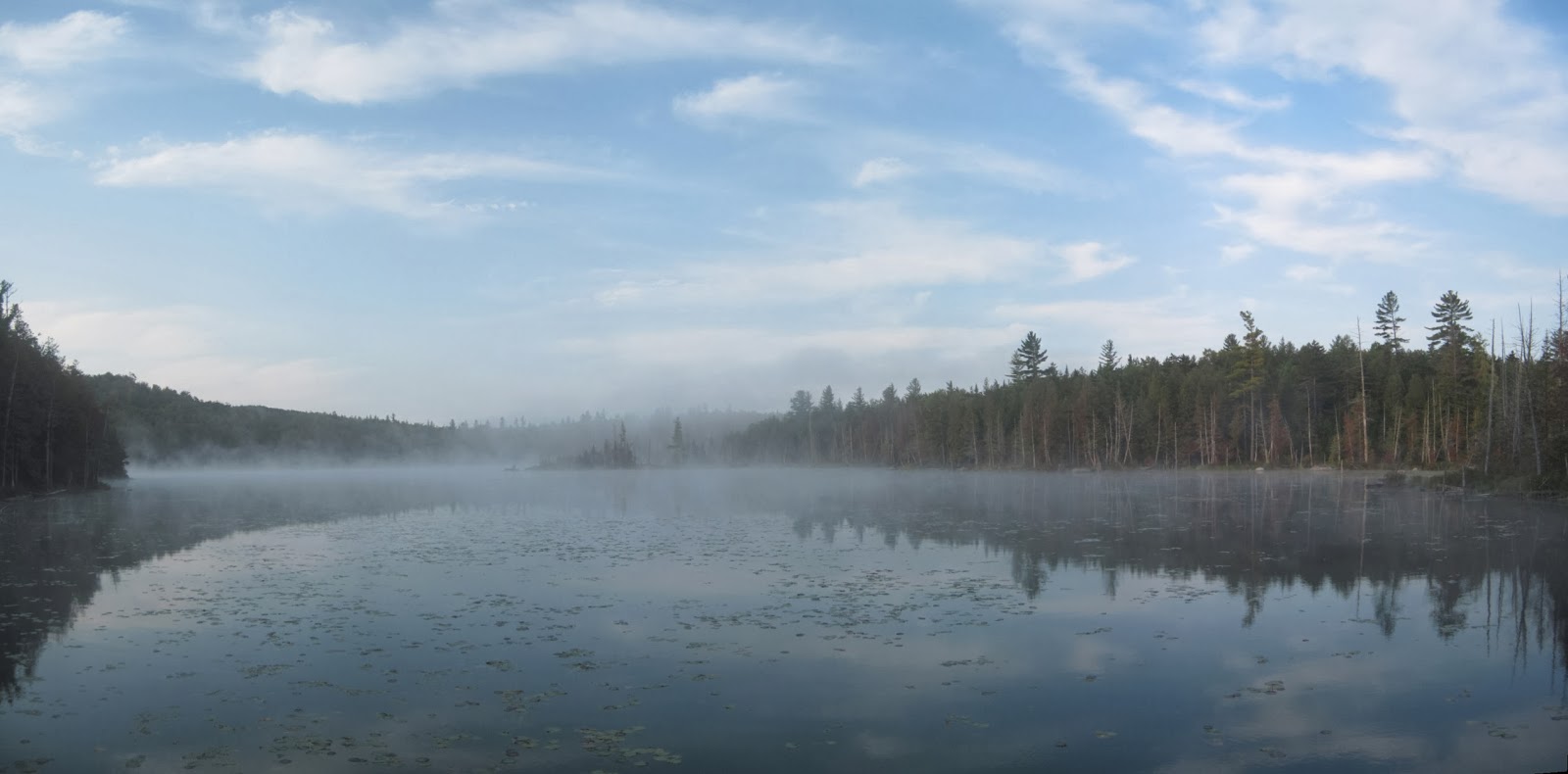
A cool early morning on the Hudson

I continued on to Lake Jimmy where I crossed the delapidated planks without too much trouble (Note: Lake Jimmy now has a bypass trail instead of the boardwalk). I continued past the Mt Adams Trail and after a couple of turns I was alongside the Opalescent River. It was along this stretch that I scared up a large creature which splashed from the river into the brush, I only caught a glimpse but since it was big and black I'd say it was a bear! My first wild sighting while hiking. I came to the Opalescent River crossing, which was also easily crossable. I stashed my watershoes near the river to get on the way back.


Lake Jimmy Boardwalk (*Since Removed)


Early Morning on Lake Jimmy


The Opalescent River

I arrived at the junction with the trail to Mt Marcy and met a father/daughter hiking duo headed for Allen. We continued on together and I learned that they would be finishing their 46'er quest on Whiteface Mtn. We followed the Allen Herdpath to where it intersects the private road and parking area. We signed into the DEC sign in box there and we headed up the herdpath towards Allen. We crossed Skylight Brook and then the herdpath brought us up Allen Brook. Towards the top the terrain got very steep and their was some open rock, the views behind us as we climbed started to open up. This part was tricky as some of it was wet and slippery, but we made it up without too much trouble. We reached the ridge and the summit was a short walk further. The summit is wooded but there are various openings and views nearby.


Steep section of the slide


View from the slide


Allen Summit


Western View


Eastern View


Southwestern View


Northern View

We had lunch and then started our descent. There was a couple of slip ups but nothing serious. The rest of the trip was just going back over the terrain from earlier in the day. The weather remained nice and we made good time back to the trailhead. I congratulated my two hiking companions on their impending 46'er finish and headed home after a long but fullfilling day in the woods.


Hommade ALLEN sign


View from Upper Works Rd on the drive out

Monday, July 30, 2012

SEYMOUR MTN ADK 46'ER (The "High Peaks Intercom" Hike)

I headed out for a solo hike of Seymour Mtn in the Western High Peaks, I arrived at the Seward Range Trailhead and headed out. I mad quick time as the approach to the mountain is a long hike over fairly level terrain. I passed a group of campers at Blueberry Lean-To before I came to the Ward Brook Trail. I took that past the Ward Brook Lean-To to the start of the Seymour Herdpath. The Herdpath was easy to follow but was steep. I reached the summit fairly quickly and headed back over to the nearby viewpoint for lunch. The weather was fantastic. I took the opportunity to call "mountain intercom" my friend Tracy who was hiking in the MacIntyre Range with her daughter. They were having a good hike and she wished me a good hike. I took a bunch of photos and enjoyed the nice weather.


Seymour Summit Marker


View South from Seymour Summit Area


 Flower at Seymour Summit


At the Overlook Ledge near Seymour's Summit


View from Seymour Ledge


I headed down and ran into a few hikers ascending, we chatted and then I was off. I checked out the slide that runs along near the herdpath.


Bunchberry


Seymour Herdpath


Slide near the Seymour Herdpath


Amanita Mushroom

Back down at Ward Brook Lean-To I picked up some stuff I had stashed on the way in and had a snack. The long hike back to the car was made pleasant by the nice weather. I passed the Blueberry Lean-To and  also spotted a few interesting trees on my walk out.


Ward Brook Lean-To


Southern End of Ward Brook Trail


Trail back to Santanoni Parking PA


Blueberry Lean-To


An interesting gnarled tree


Tree growing on a boulder

On the way out I stopped by Stony Creek Ponds for a kayak. I launched and checked out some cardinal flowers and saw some ducks. I swam a bit and hung out on shore. I was treated to watching a loon diving for a while as well. It was a pleasant paddle and a good addition to the day.


Fallen Birches and Cardinal Flowers in Stony Creek Ponds


Cardinal Flower


Marsh Flowers


Relaxing in the Noodle Chair 
(Note: I did see leeches in the pond)


Snail


Loon showcasing it's camouflage


A nice quiet spot

I stopped to photograph Simon Pond in Tupper Lake, which was a really nice scene. I made a couple other photo stops along the way to break up the long drive home.


Simon Pond -Tupper Lake


Rock Island Bay - Tupper Lake


Grampus Lake Outlet - Long Lake


High Peaks Overlook - Newcomb

Friday, July 20, 2012

SANTANONNI RANGE 46'ERS (The "Bear Spray" Hike)

MtnManJohn (John), TAG (Tracy) and I arrived at the Santanoni Trailhead and set out around 7AM. We had a very long day of hiking planned. We made quick work down the private road and onto the Bradley Pond Trail. There was a new reroute around a notoriously muddy stretch of trail not long before the Bradley Pond Lean-To. We stopped to snap a few pictures of Santanoni Brook on the way in.


Santanoni Brook


Re-route of the Bradley Pond Trail

We then passed the cairn marking the start of the Santanoni Express Herdpath. We continued on to the Bradley Pond Lean-To and took a break. Once we checked our bearings we headed into the woods behind the lean-to to start a bushwack to the summit of Henderson Mtn (ADK Hundred Highest Peak). It was very thick balsam and after pushing through and ascending the steep grade we finally got to the highpoint. There was a partial view of the High Peaks from the summit area.


Difficult Bushwack on Henderson (Photo couresy of TAG)


Henderson Summit (Photo courtesy of TAG)


View from Henderson Mtn

We headed down after taking some photos. Almost back down to the main trail my bear spray got caught in the brush and discharged a small amount. As soon as I heard the sound I told everyone to clear out. My eyes were burning and TAG's tongue was numb. We made it back down to the trail and recouped. I noticed I had lost my glasses in the fray, I decided to not bother going back to locate them.


The infamous Bear Spray! (Photo courtesy of TAG)

Once we recovered from the pepper spray ordeal we headed out for the Panther Brook Herdpath into the Santanoni Range. We found the trail and crossed a beaver dam, passed Bradley Pond and started our ascent up the brook.


Beaver Flow at the start of the Panther Brook Herdpath


Bradley Pond


Panther Brook Herdpath

As we ascended the herdpath we came upon a viewpoint. We stopped to filter water and then continued up to Herald Square where we dropped our packs and took the short trail over to Panther Peak. There were really nice open views from Panther's summit area. We could see over to our next objective Couchsachraga Peak, which looked difficult to reach. 


Panther Summit (Photo courtesy of TAG)

Views from Panther Summit


We headed back down, picked up our bags and headed over to Times Square. We took a break there to get ready for the trip over to "Couchie". TAG said she was going to wait for us and then we could all head over to Santanoni Mtn together. MtnManJohn and I headed out on the herdpath to "Couchie". The sun came out and the miles were starting to take their toll, we didn't bring enough water for the hike over and we were both dealing with dehydration. We took a couple pictures at the summit and then headed back to Times Square where we had more food and water stashed. 


Break at Times Square (Photo courtesy of TAG)


Viewpoint along Couchie Herdpath


Glacial Erratic on Couchie Herdpath


Couchsachraga Summit

It was a tough climb back up to the ridge, but when we arrived we ate and drank and got some energy back. TAG was a bit cold and had some bug issues so she decided to head over to Santanoni and meet us there. She left us a note in the dirt with her departure time. We caught up to her near the summit of Santanoni and we all went to the summit and enjoyed beautiful late afternoon views from the summit area. 


TAG's note at Times Square (Photo courtesy of TAG)


Santanoni Summit (Photo courtesy of TAG)

Views from Santanoni Summit


We took the Santanoni Express trail back down to the Bradley Pond Trail. As the light was fading into darkness we came out on the private road and made it back to the trailhead at about 9PM. Four mountains 16+ miles and 14 hrs in the woods, what an adventure.


A steep ledge on the Santa Express Herdpath


The end of another adventure, exhausted but happy (Photo courtesy of TAG)