Friday, March 23, 2012

FRIDAY & BALSAM CAP 2 CATSKILL 35 BUSHWACKS (The "Friday on Friday" Hike)

I met up with Tracy (TAG) in Saratoga, then we met up with Jim (Woodsman) and Chris (FreezeFrame) in Albany for a trip to the Catskills. I drove us down to the parking area at the end of Moonhaw Rd. We began our bushwack up some old logging roads until we got near a private cabin, where we started the steady climb up the ridge to Friday Mtn. We came upon a tree with this interesting formation along the way...
We continued up the ridge and eventually found a herdpath that led us up through some cliffs...
We were soon in a pine forest and we found the canister on the wooded summit and signed in...
We enjoyed some snacks and a small view through the trees towards Cornell and Wittenberg Mtns...
We descended past the cliffs towards Balsam Cap Mtn...
After a little route-finding we stumbled on  herdpath along the ridgline which led us through a nice pine forest...
 The path led us to a nice overlook of the Cornell & Wittenberg Mtns and the Ashokan Reservoir...

After climbing trees to get a better view we headed up the trail to the wooded summit of Balsam Cap and signed into the canister...
We headed back down, but instead of going back the way we came we decided to check out a large plane crash on the way back. The route was very steep and rocky down to the crash site but we found it...
It was a WWII B-25 Bomber that crashed here in 1948 taking the lives of the three airmen aboard.
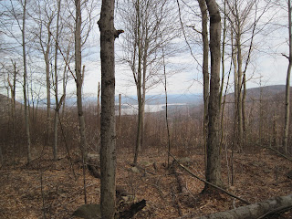
We continued back down the mountain and came out near the private cabin where there was one last view of the Ashokan Reservoir through the trees...
 It was near here that we spotted lots of bear scat and tree claws but never saw any bears.
I found some early wildflowers, Yellow Violets along the way back to the car...
We descended back down to the car. Two Catskill bushwacks and a plane wreck, a nice day to be in the mountains. And of course, we hiked Friday on Friday!

Note: Some photos couresy of TAG

Monday, March 19, 2012

COLVIN & BLAKE ADK 46er's (The "Gut Check" Hike)

I headed up to do Colvin & Blake Mtns in the Adirondacks because last time I only hiked Colvin and Blake is one of the 46, so I went back to climb that as well. I headed up to the Ausable Club TH to start my hike. The day was cool in the morning, but was destined to be very hot before the end. I reached the turn off from Lake Rd for Colvin Mtn fairly quickly. I had decided to wear my sneakers (my favorite shoes to hike in!), in the dryer lowlands on this hike..
I ended up leaving them on all the way to Colvin's summit with my microspikes for traction. 
I stopped for a rest at a waterfall at the trail junction with the Gill Brook Trail...
My shoes and socks were soaked from the wet snow and ice on the way up, but I brought extra socks & boots to change into. I met a couple other hikers along the trail and we reached the summit, ate snacks and chatted for while enjoying the views of The Great Range and Lower Ausable Lake...

The other hikers headed down and I prepared to head over to Blake Mtn. I started down the trail and came to a southern overlook of Upper Ausable Lake and Blake Mtn...
The next leg of the trip is one of the toughest hiking experiences I've had in my years of hiking, I underestimated the poor snow conditions and temperatures and it made for a very exhausting trip through the deep col to Blake and back. I had snowshoes but the snow was so soft it was no use to put them on, the terrain was very steep and the temps had me sweating and out of water. It was a true "gut check" getting back to Colvin where I had left 1/2 an iced tea on the summit. There were some nice views along the way which helped distract me from my physical predicament...
The ladder down to the col...
Near Blake Mtn Summit...
Blake Mtn Views...
Some steep icy/snowy terrain...
A view of Colvin Mtn...
A view of Nippletop/Dix Mtns...
The Col between Blake/Colvin...
When I reached this rock along the trail it seemed to signify the journey I had taken between the two mountains...
I reached the summit of Colvin again and had some tea and headed back down towards Lake Rd. I heard a couple rumbles of thunder and even saw a small rainbow in the distance...
When I reached the Lake Rd, I was extremely tired but felt better that I had a road to walk on for the last few miles to the car, I stopped at Artist Falls along the way...


Further down the road the mist was rising off Gill Brook...
I made it back to the Lake Rd gate, totally exhausted and sore but glad to have been outdoors all day in the mountains!
I learned a valuable lesson about how much fluid to bring on early spring hikes in case of hot temps, also I will always bring my water filter on all longer hikes from now on. Even with the "gut check" it was still a great day to be out and the views were splendid!

Friday, March 9, 2012

PANTHER & SLIDE 2 CATSKILL 35 WINTER MTNS (The "Two Seasons" Hike)

Chris (FreezeFrame) and I met up in Schenectady and headed down to the Catskills for a "winter" hike of Panther Mtn. We arrived at the Giant Ledge TH and headed up the trail, it was chilly but was warming up with the sun. We made it fairly quickly up to Giant Ledge and enjoyed the views...

The day was warm and we were enjoying the springlike weather, not knowing the second hike of the day would be much different. We put microskpikes on to climb Panther Mtn because there was some icy patches along the way...
We continued up the trail and reached the summit where we ate and enjoyed the view...


We headed back down enjoying the warm sunny weather back across the Ledge and to the car.
We made such good time on the hike we decided to drive up the road a few miles and hike Slide Mtn.
The sky was starting to fill up with clouds as we ascended the wide path up the mountain. We made it up to the first overlook just as a storm was blowing in...
By the time we reached the summit it had started to snow, I showed Chris the Burroughs Plaque and then we ate a snack and geared up for the winter weather...


It snowed off and on back down to the car. 2 different seasons in 1 hike, a great day to be out in the woods!


Monday, April 27, 2009

PHARAOH MTN HIKE (The "Summer in April" Hike)

I hiked Pharaoh Mountain from Crane Pond Rd. My hike began at the ford on Crane Pond Road in the Pharaoh Lake Wilderness. I decided not to try to cross the ford and hiked the .3 miles to Crane Pond.


Where the road ends a trail crosses Crane Pond on a wooden bridge and begins down an old woods road.


After about 1/2 mile I reached a trailmarker indicating a right turn to ascend Pharaoh Mountain. I met a couple of nice DEC Forest Rangers doing trail maintenance here, and thanked them for their hard work. They were the only people I met all day on the trail.


This guy caught me by surprise as I trodded down the path, he was right next to the trail at a stream crossing.


These yellow violets were in bloom, as I ascended the mountain on this unseasonably hot 80 degree April day.

After some difficult steep climbing I reached the top. There wasn't a 360 degree view from the summit, but I enjoyed excellent views from several outcrops around the summit, this one is looking east over Pharaoh Lake.


I always enjoy finding a survey marker from Verplanck Colvin, his work as a surveyor in the late 1800's paved the way for the present Adirondack Park to be established. Colvin is a rather unnapreciated part of Adirondack history, and I think should have the recognition that the likes of John Muir get.

There was once a firetower on the summit, but it was destroyed by fanatical environmentalists who didn't believe in having structures in Wilderness areas. Even without the tower the views to the northwest of the High Peaks were superb.


After some photos and a snack I descended back down to the lowlands and a more gentle grade.


I stopped as the trail passed Glidden Marsh and took this panoramic photo of Pharaoh Mountain accross the marsh. There are many small ponds in this area, with campsites and lean-to's.


As the sun fell in the sky and the light became softer I passed back over and took one last look at Crane Pond before returning to my car for the ride home.

On the drive out, I located this nice waterfall along Crane Pond Road that I couldn't resist to snap some photos.
This was my second trip into the Pharaoh Lake Wilderness and it won't be my last, it's a remote and beautiful area with plenty of hiking, fishing and camping opportunities.

EveryTrail Guide To Pharaoh Mtn


Monday, October 18, 2004

BERLIN MTN TACONIC MTNS (THE "SCOUTING WITH DAD" HIKE)

The plan was to hike the Taconic Crest Trail from Petersburg Pass to Berlin Mtn to see if it was suitable for mountain biking. My father and I arrived at Petersburg Pass on a cool and cloudy fall day.


Petersburg Pass Trailhead


Petersburg Pass View


View Northwest from Petersburg Pass

The leaves covered the trail as we headed towards Berlin Mtn. The trail was wide and showed some signs of illegal ATV/4X4 use. We passed through Berlin Gap and up to the flat summit. There was the footings for the old fire tower which was taken down. The view of Mt Greylock the Massachusettes high point was ver nice to the East. The rolling hills and farmland of New York's Hudson Valley to the West.


Leaves on the trail


Trail Marker


Nice Fall Forest


Berlin Mountain Summit


Mt Greylock from Berlin Summit


We hiked back to Petersburg Pass and concluded that the terrain was too steep and loose to make it a good mountain bike trip. It did however turn out to be a rather nice place to hike for the day with my dad.